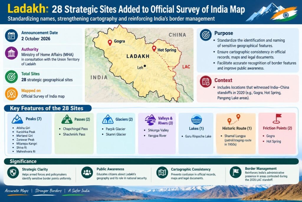
The Government of India has formally identified 28 strategic geographical sites in Ladakh on the official Survey of India map, including the LAC friction points Gogra and Hot Spring. The move aims to standardize the names of important border features and improve consistency in official mapping and border management.
- Date: 2 October 2026
- Authority: Ministry of Home Affairs (MHA), in consultation with the UT of Ladakh
- Sites covered: Peaks, passes, glaciers, valleys, rivers, lakes and patrol routes
- Key friction points: Gogra and Hot Spring
- Notable peaks: Atisha Giri, Kanishka Peak, Martand Giri, Zorawar Peak and Milarepa Kangri
- Other features: Chapchingal Pass, Parpik Glacier, Skamri Glacier, Shkorga Valley, Yangpa River and Guru Rinpoche Lake
- Historical route: Shamal Lungpa, associated with patrol/staging activities in the 1950s
The initiative is intended to promote cartographic consistency, public awareness and uniform identification of sensitive geographical locations, particularly those associated with the India–China border and the 2020 LAC tensions.