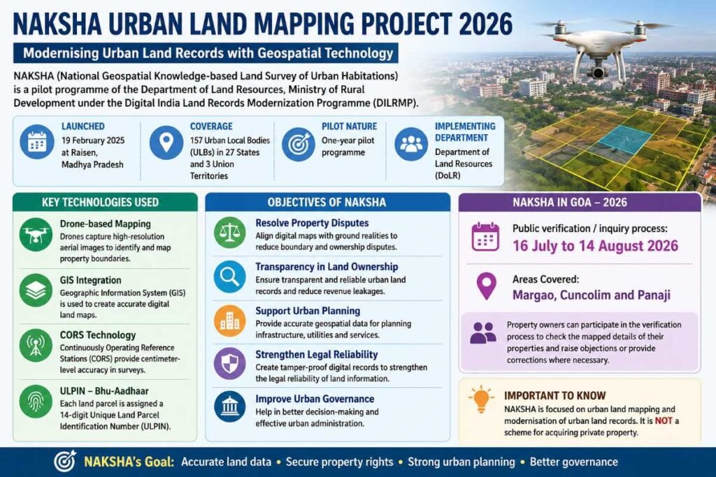
NAKSHA stands for National Geospatial Knowledge-based Land Survey of Urban Habitations. It is a pilot programme of the Department of Land Resources (DoLR), Ministry of Rural Development, aimed at modernising urban land records through advanced geospatial technology.
The NAKSHA pilot was launched on 19 February 2025 at Raisen, Madhya Pradesh. It covers 157 Urban Local Bodies (ULBs) across 27 States and 3 Union Territories.
Key Features of NAKSHA
- Drone-based mapping: Drones are used to capture high-resolution aerial images of urban areas and accurately identify property boundaries.
- GIS technology: Geographic Information System (GIS) is used to create and manage digital land maps.
- CORS: Continuously Operating Reference Stations help achieve highly accurate positioning for land surveys.
- ULPIN: Each land parcel can be assigned a 14-digit Unique Land Parcel Identification Number (ULPIN), also known as Bhu-Aadhaar.
- Digital land records: The project aims to create accurate and tamper-resistant digital records of urban land parcels.
Objectives of NAKSHA
The main objectives are to:
- Reduce property and boundary disputes.
- Improve transparency in urban land ownership.
- Provide accurate land data for urban planning and infrastructure development.
- Strengthen the reliability of digital land records.
- Help improve urban governance and reduce revenue leakages.
NAKSHA in Goa – 2026
In Goa, the public verification/inquiry process under the NAKSHA pilot is being conducted from 16 July to 14 August 2026.
The process covers Margao, Cuncolim and Panaji. Property owners can participate in the verification process to check the mapped details of their properties and raise objections or provide corrections where necessary.