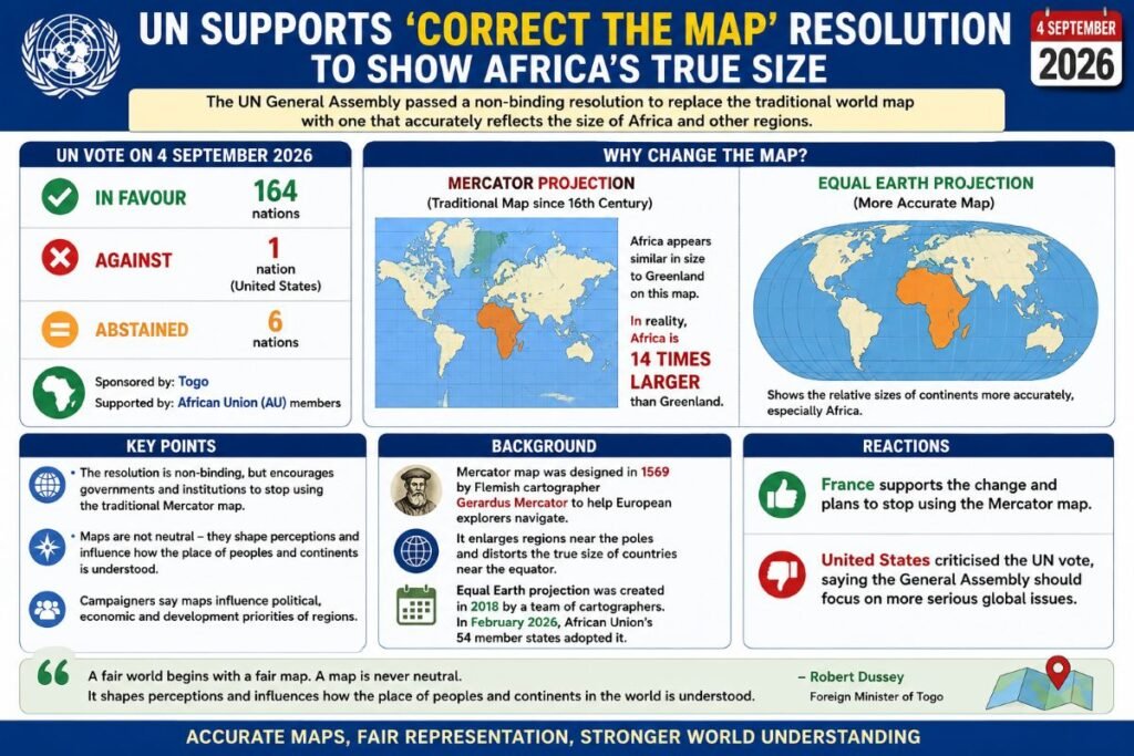
The UN General Assembly on 4 September 2026 supported replacing the traditional Mercator world map with a map that more accurately represents the actual size of continents, particularly Africa.
- The “Correct the Map” resolution, sponsored by Togo and backed by African Union members, received 164 votes in favour.
- The United States voted against the resolution, while six countries abstained.
- The resolution is non-binding, but aims to encourage governments and institutions to move away from the traditional Mercator projection.
- The Mercator map, created by Gerardus Mercator in 1569, significantly enlarges regions near the poles.
- Africa appears much smaller than its actual size on the Mercator map; in reality, Africa is about 14 times larger than Greenland.
- The Equal Earth projection, developed in 2018, provides a more accurate representation of the relative sizes of continents.
- The African Union’s 54 member states adopted the Equal Earth projection in February 2026.
- France supported the change and plans to stop using the Mercator map, while the US criticised the UN vote as a distraction from more serious global issues.
- Supporters argue that maps influence how people perceive the political, economic and geographical importance of different regions.