India’s Strong Performance at Commonwealth Games 2026
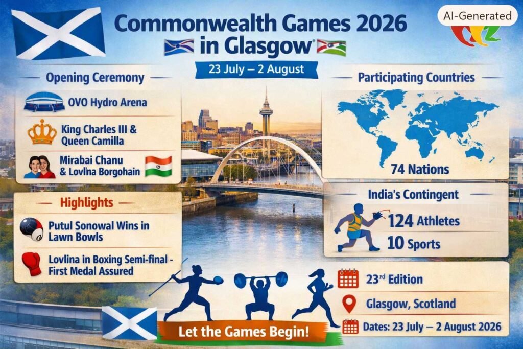
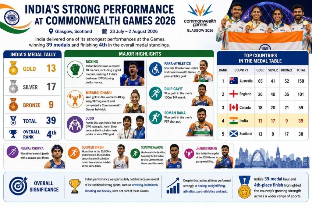
The Commonwealth Games 2026 were held in Glasgow, Scotland, from 23 July to 2 August 2026. India delivered one of its strongest performances at the Games, winning 39 medals and finishing 4th in the overall medal standings.
India won 13 gold, 17 silver and 9 bronze medals. Boxing was the biggest success for India, while weightlifting, athletics, para-athletics and judo also produced several historic achievements.
India’s Medal Tally
- 🥇 Gold: 13
- 🥈 Silver: 17
- 🥉 Bronze: 9
- 🏅 Total: 39
- Overall Rank: 4th
Major Highlights
- Boxing: Indian boxers won a record 10 medals, including 7 gold medals, making it India’s best-ever Commonwealth Games boxing performance.
- Mirabai Chanu: Won gold in the women’s 48 kg weightlifting event and completed a Commonwealth Games hat-trick.
- Judo: Asmita Dey won India’s first-ever Commonwealth Games judo gold. Harsh Singh became the first Indian male judoka to win a CWG gold.
- Para-athletics: Sharmila Dhankar won India’s first Commonwealth Games para-athletics gold.
- Dilip Gavit: Won gold in the men’s 100m T47 event.
- Soman Rana: Won gold in the men’s F57 shot put.
- Neeraj Chopra: Won silver in men’s javelin with a season-best throw.
- Gulveer Singh: Won silver in the 10,000m and bronze in the 5,000m, becoming the first Indian to win two athletics medals at the same Commonwealth Games.
- Tejaswin Shankar: Won bronze in the decathlon, becoming the first Indian to win a Commonwealth Games decathlon medal.
- Jhandu Kumar: Won India’s first medal of the 2026 Games in para powerlifting.
Top Countries in the Medal Table
| Rank | Country | Gold | Silver | Bronze | Total |
|---|---|---|---|---|---|
| 1 | Australia | 65 | 41 | 52 | 158 |
| 2 | England | 26 | 40 | 35 | 101 |
| 3 | Canada | 18 | 20 | 21 | 59 |
| 4 | India | 13 | 17 | 9 | 39 |
| 5 | Scotland | 13 | 8 | 17 | 38 |
Overall Significance
India’s performance was particularly notable because several of its traditional strong sports, such as wrestling, badminton, shooting and hockey, were not part of these Games. Despite this, Indian athletes performed strongly in boxing, weightlifting, athletics, para-athletics and judo.
India’s 39-medal haul and 4th-place finish highlighted the country’s growing strength across a wider range of sports.